Familiarizing myself with information about Angkor Wat on the web, I discovered almost same things written everywhere; simply speaking, the information was taken from a single source, though many do not refer to that source, as if they wrote it themselves. I will use the same source, but will also indicate the primary source not mentioned by many. The primary source is the book Heaven’s Mirror: Quest for the Lost Civilization by Graham Hancock and Santha Faiia. A connection between Angkor and the sky was ascertained by John Grigsby who cooperated with Hancock in 1996. I refer to the primary source, so that everyone who desires could get to know more detailed information on the subject, while I shall only cite extracts and give some comments.
Name (source – Wikipedia different language versions): Most probably, the name Angkor originates from the Sanskrit nagara (Devanagari: नगर), meaning “city”. In the Khmer it is read as noko (Khmer: នគរ– “kingdom, land, city”), however in common parlance Khmers feel more comfortable saying ongko. The last word version is consonant with the notion of harvest, which is native for local peasants and may be literally translated as “rice grains collected”.
Name (source – Heaven’s Mirror…): Though the word Angkor is considered a perverted Sanskrit word nagara (“city”), there is its precise meaning in the ancient Egyptian language: “god Horus lives”. The word combination Anh-Hor may also be translated as “May god Horus live”, “Horus lives” and “Life be in Horus”. (source – Heaven’s Mirror…)
Geography: Accurate linkage of longitude lines in the graticule that we use today is a political issue. According to the convention jointly adopted in the 19th century, the first line of the graticule – 0 degrees longitude, or the so-called prime meridian – passes through the Royal Observatory in Greenwich, London. The Pyramids of Giza are located 31.15 degrees to the east of the Greenwich meridian, ancient Heliopolis is at 31.2 degrees East, whereas Angkor Wat temples are at 103.5 degrees East. That is, the distance between the sacred land of Giza – Heliopolis, where sages ruled, who went along the astronomical “road of Horus”, and the sacred land of Angkor, the name of which literally means “god Horus lives”, upon little rounding makes up a geodetically significant number of 72 degrees of longitude (103° – 31° = 72°).


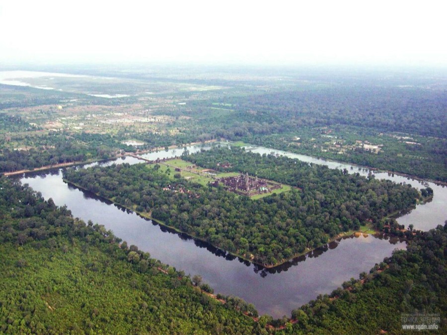
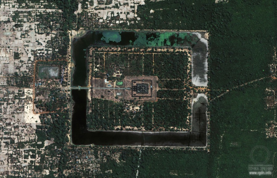
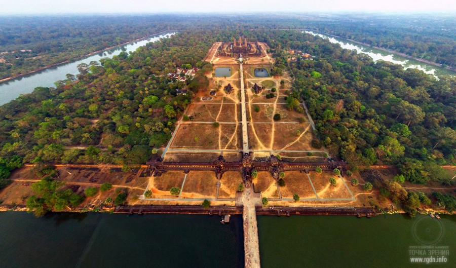
Now, let’s mentally fly up higher above the sacred complex in order to embrace its entire 300 square kilometres with our eye. The large rectangle of Angkor Wat and the four times larger square of Angkor Thom are located on the western side of the landscape we see below. Within 25 kilometres to the east and 15 kilometres to the north, there are ruins of numerous other temples, surrounded by the jungle, yet still observable. Those temples were also constructed by Khmer godlike kings who erected the larger monuments as well. Small or large, by their contours the temples repeat the geometry of a space mandala or yantra.
Are they connected with one another? Maybe, we should examine them altogether as a certain mandala reproducing some space contours in a large scale?
Among the extant triumphal inscriptions of Khmer king Jayavarman VII who built Angkor Thom and Bayon in the 12th century AD, a mysterious phrase was discovered on a stele dug out in the royal palace area: “The land of Kambu (Cambodia) is similar to the sky”. (Here we find a very interesting point, since Egypt is as similar to the sky. In the Hermetism text known as Asclepius there are the following words: “Do you not know, Asclepius, Egypt is an image of heaven, or, to speak more exactly, in Egypt all the operations of the powers which rule and work in heaven have been transferred to earth below? Nay, it should rather be said that the whole Kosmos dwells in this our land as in its Sanctuary.”) A person who knows about the ancient Egyptian heaven-earth dualism may naturally have a question: doesn’t this reflect the practice of erection of architectural models or “copies” of certain heavenly stars or constellations on the Earth?
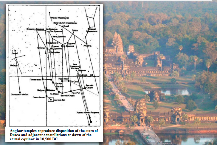
In 1996 John Grigsby, a 25-year-old doctorate seeker, was collecting a database on Angkor for us and made a brilliant discovery. It turns out just like the three Great Pyramids of Giza in Egypt model the stars of the southern Orion constellation Belt the main structures of Angkor model the wavy spiral of the northern Draco constellation.
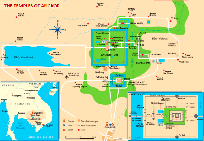
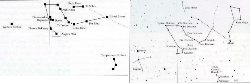
Angkor temples quite precisely imitate the Draco constellation!
Such correlation is beyond any doubt: correspondence between the main stars of Draco constellation and at least 5 major pyramidal temples of Angkor is too obvious to be called otherwise. Moreover, such correspondence applies to a number of adjacent constellations located in the same region of the starry sky. Therefore, the only question that requires an answer is whether such correspondence is an accidental coincidence or a result of deliberate activity. However, as Grigsby indicates:
“If this is a coincidence, it’s totally amazing. And it’s not only that Draco stars are located similarly to Angkor temples, taking into account the orientation by cardinal directions the distance between the stars correlates to the distance between the temples with high precision, given all this is a result of a rather complex process in which they had to rely not on detailed images of the constellation, but on manually drawn maps. There is a certain error tolerance when a person maps stars and then projects such map onto a complex-relief locality with an area of hundreds of kilometres, not being able to control construction from the air. Taking this into consideration, the probability for the Draco stars to be a template for Angkor layout further increases. And not just the Draco stars, but also Alkaid and Kochab situated nearby and forming a straight line with Thuban – which also has an “accidental” analogue on the Earth – as well as Deneb in the Cygnus constellation which is correlated by the West Medon temple. It is also noteworthy these temples were being erected in about 250 years, and there are evidences that the sites of more ancient buildings were used for them (e.g., Bayon, Baphuon and Phimeanakas). Thus, quite possibly, the temples disposition was mapped before, when the entire construction was planned.”
But there is a question: when was it planned? In search of the answer to this question we encountered a rather extraordinary mystery.
To verify Grigsby’s hypothesis of the Draco-Angkor correlation we used the same Skyglobe 3.6 programme that had identified the astronomical “template” by which the three Great Pyramids and the Great Sphinx had been built in Giza. The programme’s major advantage is that it allows estimate precession impact on position of stars and accurately imitate the starry sky image, making it possible to observe it so as it could look from any point of the Earth’s surface, in any age with a precision of given month, day, hour and minute. Grigsby did not consider a date on which the Draco-Angkor correlation could be performed; he only mentioned the correlation was of a general character and obvious in all ages. At that, we assumed since the correlation objectively existed it had to be datable. We believed that, if the temples disposition on the Earth was indeed a result of a deliberate action on reproduction of the Draco stars, precession estimations could provide us with an answer which exactly sky copied the temples – in other words, the sky of which age.
There are indisputable archaeological and tectological evidences that Angkor temples were built by concrete and famous Khmer monarchs, and almost all of them ruled within four centuries between 802 and 1220 AD. Thus we assumed, if the said correlation was of a deliberate and not accidental character, it should correspond to the sky layout in those four centuries. Since precession changes within such period of time are almost indiscernible, we may consider the sky hardly changes from the four-century period beginning through its end.
At the beginning of our research we departed from 1150 AD, the year of the death of Suryavarman II, “Protected by the Sun”, Khmer divine king who erected Angkor Wat as his sepulchral temple. And, since Angkor Wat is undoubtedly the largest and most intricate building in the entire Angkor complex and its “main temple”, we decided to pay particular attention to its firm and uncompromising east-west orientation that distinguished it as “equinoctial” (in the same sense as the Sphinx is “equinoctial” – aimed at and in a sense indicating, proclaiming an accurate direction to sunrise and sunset on the vernal equinox day). Deliberate shift of the Angkor Wat axis by 0.75 degrees to the south from the strictly eastern direction and by same 0.75 degrees to the north from the western direction is a part of the overall temple design and serves for an observer as a “three-day notice” of the equinox. Such effect was well described in the Science magazine:
On the day of the spring equinox, an observer standing at the southern edge of the first projection of the causeway (just in front of the western entrance gate) can see the sun rise directly over the top of the central tower of Angkor Wat. Three days later, the sun can be seen rising exactly over the top of the central tower from the centre of the causeway, just in front of the western entrance gate… This precise observation of the sun at the spring equinox is extremely important.
Being aware of such reasoning, we decided to pay attention to the sky over Angkor at dawn on the vernal equinox day in 1150 AD. It seemed to us such estimation would be a good test for the Draco-Angkor correlation. If the correlation indeed took place at that very remarkable moment, Grigsby’s point of view would get new evidence. On the other hand, if the correlation was not performed over Angkor on the vernal equinox day in 1150 AD, we would have had a decreased probability that construction was deliberately carried out by an “astronomic template”.
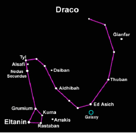
Draco is a northern constellation, near-polar at high latitudes. Thus it insignificantly shifts in the eastern or western direction during its nigh travel. Or rather it slowly rotates round the north celestial pole. Hence, to observe the Draco constellation an observer should look to the north. This also implies that, if Angkor temples were planned as a “copy” of Draco on the Earth, they should also be observed, looking to the north. Generally speaking, the suggested correlation should have ideally been verified at the moment when an observer settled strictly to the north of Angkor could look straight to the north at dawn and “see” (certainly, in imagination) the great geometric walls and temples and, right above them, in the northern sky, the serpent-dragon of the Draco constellation lying along the meridian. Obviously, such a “mental image” could only be strengthened due to confidence, inherent in experienced astronomers, in the accurate position of all stars in the sky, whether they are visible or not, at noon or at midnight, at sunset or at dawn. In other words, though all stars in the sky are “swallowed" by the rising sun light at least half an hour before the actual sunrise, we were ready to assume that astronomers with qualification that ensured such orientation of Angkor Wat were quite able, similar to their colleagues in our days, estimate the Draco precise position in the sky at sunrise in any morning.
So, the Skyglobe takes us back to 1150 AD, to the vernal equinox day, 6.23 a.m.! A half of the sun disc peeps out at the skyline in the east. At that moment Draco is lying on the meridian in its night route point which astronomers call the upper culmination – but not exactly in the position we expected. Compared to Angkor temples spread on the Earth. The constellation strangely appears to be “upside down”, i.e. rotated by 180 degrees.
We made the programme replay the entire 24-hour cycle of the sky in search of the time when Draco would appear in the same position as the temples. Such moments comes in 12 hours, at 6.23 p.m. sharp, which is the exact time of the constellation’s upper culmination. Alas, no correlation is observed here either. Occupying the “right” position, Draco now (at 6.23 p.m.) settles far below the horizon, i.e. beyond visibility.
We decided to give the correlation another chance and run the entire year 1150 through the programme, and then the entire age from the 9th to the 13th centuries, in order to check whether there was at least one point when Draco was above the horizon at its lower culmination. We were a little surprised to ascertain there had been no point like that, due to quite a simple reason: within the age considered the constellation ascension (altitude above the horizon) was too low, and so the lower culmination always took place beyond the horizon. In other words, in the period when, according to our knowledge, Angkor temples were constructed there was no case – including on the vernal equinox days – when Draco would be above the horizon northern line at its lower culmination. Our first instinctive reaction was to take it as evidence that the correlation was most probably an accidental coincidence. Nonetheless, whether it’s accidental or not, it’s very difficult to disregard that the temples precisely repeat mutual disposition of the main stars of Draco constellation at its lower culmination, and that all these stars were in the sky above Angkor (and, certainly, on the meridian) at dawn on the vernal equinox day in 1150. Yet, the problem is at that time they were at the upper culmination, i.e. “upside down”. How serious is this problem? And is it really an argument supporting that the correlation is accidental? Doesn’t it seem too strange that all the stars and temples precisely correspond to each other, except that the celestial “template” is rotated 180 degrees to its “model” on the Earth?
Precession is an engine that very slowly “revolves the sky” with a period of 25,920 years; and just as slowly it changes the altitude on which stars cross the meridian. Can it happen so that computer would retrieve an age when Draco was at a higher altitude and could appear above the northern horizon (and not below) so that the temples would precisely correspond to it?
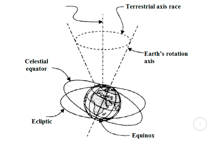
Scheme of the terrestrial axis precession
We couldn’t but recall Giza, where the correlation between the sky and the Earth was hardly perfect in 2500 BC when, as it is assumed, the Sphinx and pyramids were constructed, though, as computer imitation indicates, a total analogy was observed at dawn at the vernal equinox in 10,500 BC. And we couldn’t but recall that the Sphinx and pyramids were as if especially planned to promote understanding of immense changes undergone by the sky during the long-lasting precession cycle. Do you remember such cycle evolves at a speed of 1 degree per 72 years? And now recall that Angkor is located 72 degrees to the east of Giza, where the Sphinx and pyramids are. Although there is no archaeological evidence of any construction (and any human population either) in Angkor in 10,500 BC, we felt we had to check how the sky had looked in that remote age. Since the sunrise at the vernal equinox in 10,500 BC occurred at the moment when the entire layout of the Earth and the sky was in precise correspondence, including Orion’s location on the meridian, we assigned the computer to imitate the sky above Angkor right at dawn on the vernal equinox day in 10,500 BC. And we were not mistaken: Orion swimmingly appeared precisely in the south on the meridian – just like in Giza; the only difference was in the perspective change caused by Angkor’s lower latitude – 13 degrees 26 minutes north compared to Giza’s 30 degrees 3 minutes. At that, Leo swimmingly appeared precisely in the east, right above the rising sun, like in Giza. The only difference was a slight slope of the constellation as a result of the latitude change.
Then we assigned the computer to look to the north, although we had neither ever paid attention to the northern sky over Egypt nor expected to see anything special there. And we were surprised, having discovered that at dawn on the vernal equinox day in 10,500 BC the Draco constellation appeared precisely in the north in the middle of the sky, lying on the meridian quite high above the horizon and precisely reproducing in the sky the disposition of Angkor main temples on the Earth. Thus, here in Giza there is also a certain point in the precession cycle, when an accurate correlation between the earth and sky layouts is observed, and such point is quite remote to the past. It is noteworthy in both cases such point coincides! It’s also interesting that Angkor temples neither model any random constellation nor mimic the two constellations used in Giza, i.e. Orion and Leo which marked the south and the east in the dawn sky at the vernal equinox in 10,500 BC; instead they model the Draco constellation wriggling like a snake, which at that point locates straight in the north.
So, in Giza there are “Orion temples” – the Great Pyramids that looked like Orion in 10,500 BC, and “Leo temples” – the Sphinx with its lion body and the adjoining buildings, altogether reproducing Leo of the same remote year. And if there is a secret connection between Giza and Angkor, wouldn’t it be quite logical that the latter extended this line, imitating on its several hundreds of square kilometres the Draco constellation, “the Old Serpent”, as it looked in 10,500 BC?
In 1993 there was an astonishing new discovery which suggested that there was much still to learn about Ancient Egypt. The discoverer, moreover, was not 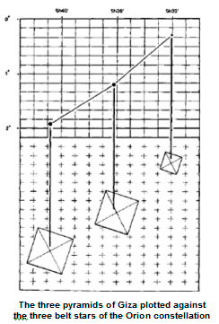 some astigmatic archaeologist sieving his way through the dust of ages but an outsider to the field: Robert Bauval, a Belgian construction engineer with a flair for astronomy who observed a correlation in the sky that the experts had missed in their fixation with the ground at their fleet.
What Bauval saw was this: as the three belt stars of the Orion constellation crossed the meridian at Giza they lay in a not quite straight line high in the southern heavens. The lower two stars, Al Nitak and Al Nilam, formed a perfect diagonal but the third star, Mintaka, appeared to be offset to the observer’s left, that is, towards the east.
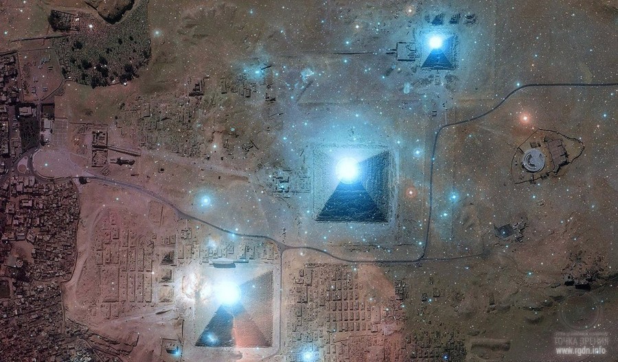
Curiously enough (as we saw in Chapter Thirty-six), this was exactly the site-plan of the three enigmatic pyramids of the Giza plateau. Bauval realized that an aerial view of the Giza necropolis would show the Great Pyramid of Khufu occupying the position of Al Nitak, and the Second Pyramid of Khafre occupying the position of Al Nilam, while the Third Pyramid of Menkaure was offset to the east of the diagonal formed by the other two – thus completing what seemed at first to be a vast diagram of the stars.
Was this indeed what the Giza pyramids represented? I knew that Bauval’s later work, which had been wholeheartedly endorsed by mathematicians and astronomers, had borne out his inspired hunch. His evidence (reviewed fully in Chapter Forty-nine) showed that the three pyramids were an unbelievably precise terrestrial map of the three stars of Orion’s belt, accurately reflecting the angles between each of them and even (by means of their respective sizes) providing some indication of their individual magnitudes. Moreover, this map extended outwards to the north and south to encompass several other structures on the Giza plateau – once again with faultless precision. However, the real surprise revealed by Bauval’s astronomical calculations was this: despite the fact that some aspects of the Great Pyramid did relate astronomically to the Pyramid Age, the Giza monuments as a whole were so arranged as to provide a picture of the skies (which alter their appearance down the ages as a result of precession of the equinoxes) not as they had looked in the Fourth Dynasty around 2500 BC, but as they had looked – and only as they had looked – around the year 10,450 BC.
***
West’s evidence focused on certain key structures, notably the Great Sphinx and the ValleyTemple at Giza and, much farther south, the mysterious Osireion at Abydos. He argued that these desert monuments showed many scientifically unmistakable signs of having been weathered by water, an erosive agent they could only have been exposed to in sufficient quantities during the damp ‘pluvial’ period that accompanied the end of the last Ice Age around the eleventh millennium BC. The implication of this peculiar and extremely distinctive pattern of ‘precipitation induced’ weathering, was that the Osireion, the Sphinx, and other associated structures were built before 10,000 BC.
A British investigative journalist summed up the effect:
West is really an academic’s worst nightmare, because here comes somebody way out of left-field with a thoroughly well thought out, well presented, coherently described theory, full of data they can’t refute, and it pulls the rug out from beneath their feet. So how do they deal with it? They ignore it. They hope it’ll go away… and it won’t go away.
The reason the new theory would not, under any circumstances, go away, despite its rejection by droves of ‘competent Egyptologists’, was that it had won widespread support from another scientific branch of scholarship – geology. Dr. Robert Schoch, a professor of Geology at BostonUniversity, had played a prominent role in validating West’s estimates concerning the true age of the Sphinx, and his views had been endorsed by almost 300 of his peers at the 1992 annual convention of the Geological Society of America.
Since then, most often out of the public eye, an acrimonious dispute had begun to smoulder between the geologists and the Egyptologists. And though very few people other than John West were prepared to say as much, what was at stake in this dispute was a complete upheaval in accepted views about the evolution of human civilization.
According to West:
We are told that the evolution of human civilization is a linear process – that it goes from stupid cavemen to smart old us with our hydrogen bombs and striped toothpaste. But the proof that the Sphinx is many, many thousands of years older than the archaeologists think it is, that it preceded by many thousands of years even dynastic Egypt, means that there must have been, at some distant point in history, a high and sophisticated civilization – just as all the legends affirm.
My own travels and research during the preceding four years had opened my eyes to the electrifying possibility that those legends could be true, and this was why I had come back to Egypt to meet West and Bauval. I was struck by the way in which their hitherto disparate lines of enquiry had converged so convincingly on what appeared to be the astronomical and geological fingerprints of a lost civilization, one that might or might not have originated in the Nile Valley but that seemed to have had a presence here as far back as the eleventh millennium BC.
***
In his summing up at the AAAS meeting, Schoch concluded:
It’s well known that the Sphinx enclosure fills with sand very quickly, in just a matter of decades, under the desert conditions of the Sahara. And it has to be dug out periodically. And this has been the case since ancient times. Yet you still get this dramatic rolling, erosional profile in the Sphinx enclosure… S imply put, therefore, what I’m suggesting is that this rolling profile, there features seen on the body and in the Sphinx ditch, hark back to a much earlier period when there was more precipitation in the area, and more moisture, more rain on the Giza plateau.
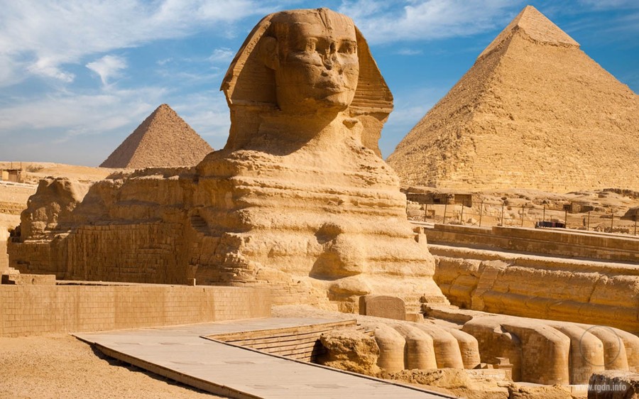
As Schoch admitted, he was not the first geologist to have noticed the ‘anomalous precipitation-induced weathering features on the core body of the Sphinx’. He was, however, the first to have become involved in public debates over the immense historical implications of this weathering. His attitude was that he preferred to stick to his geology:
I’ve been told over and over again that the peoples of Egypt, as far as we know, did not have either the technology or the social organization to cut out the core body of the Sphinx in the pre-dynastic times… However, I don’t see it as being my problem as a geologist. I’m not seeking to shift the burden, but it’s really up to the Egyptologists and archaeologists to figure out who carved it. If my findings are in conflict with their theory about the rise of civilization, then maybe it’s time for them to re-evaluate that theory. I’m not saying that the Sphinx was built by Atlanteans, or people from Mars, or extra-terrestrials. I’m just following the science where it leads me, and it leads me to conclude that the Sphinx was built much earlier than previously thought…
***
The roots of Bauval’s discoveries at Giza go back to the 1960s when the Egyptologist and architect Dr. Alexander Badawy and the American astronomer Virginia Trimble demonstrated that the southern shaft of the King’s Chamber in the Great Pyramid was targeted like a gun-barrel on the Belt of Orion during the Pyramid Age – around 2600 to 2400 BC.
Bauval decided to test the southern shaft of the Queen’s Chamber, which Badawy and Trimble had not investigated, and established that it had been sighted on the star Sirius during the Pyramid Age. The evidence that proved this was provided by the German engineer Rudolf Gantenbrink as a result of measurements taken by his robot Upuaut in March 1993. This was the robot that had made the startling discovery of a closed portcullis door blocking the shaft at a distance of about 200 feet from the Queen’s Chamber. Equipped with a high-tech on-board clinometer, the little machine had also provided the first-ever completely accurate reading of the shaft’s angle of inclination: 39o30’.
As Bauval explains:
I did the calculations and these established that the shaft had been targeted at the meridian transit of Sirius around the epoch 2400 BC. There couldn’t be any doubt about it at all. I also recalculated the Orion’s Belt alignment worked out by Badawy and Trimble with new data that Gantenbrink gave me on the inclination of the southern shaft of the King’s Chamber. He’d measured that at 45 degrees exactly, whereas Badawy and Trimble had worked with Flinders Petrie’s slightly less accurate measurement of 44o30’. The new data enabled me to refine Badawy’s and Trimble’s date for the alignment. What I found was that the shaft had been precisely targeted on Al Nitak, the lowest of the three belt stars, which crossed the meridian at altitude 45 degrees around the year 2475 BC.
Up to this point Bauval’s conclusions had been well within the chronological bounds set by orthodox Egyptologists, who normally dated the construction of the Great Pyramid to around 2520 BC. If anything, the alignments the archaeo-astronomer had come up with suggested that the shafts had been built a little later, rather than earlier, than conventional wisdom allowed.
As the reader is aware, however, Bauval had also made another discovery of an altogether more unsettling nature. Once again it involved the stars of Orion’s Belt:
They’re slanted along a diagonal in a south-westerly direction relative to the axis of the Milky Way and the pyramids are slanted along a diagonal in a south-westerly direction relative to the axis of the Nile. If you look carefully on a clear night you’ll also see that the smallest of the three stars, the one at the top which the Arabs call Mintaka, is slightly offset to the east of the principal diagonal formed by the other two. This pattern is mimicked on the ground where we see that the Pyramid of Menkaure is offset by exactly the right amount to the east of the principal diagonal formed by the Pyramid of Khafre (which represents the middle star, Al Nilam) and the Great Pyramid, which represents Al Nitak. It’s really quite obvious that all these monuments were laid our according to a unified site plan that was modelled with extraordinary precision on those three stars… What they did at Giza was to build Orion’s Belt on the ground.
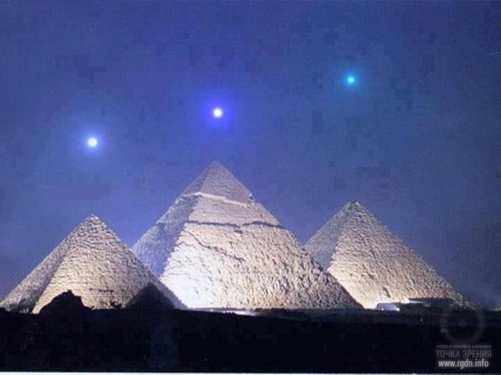
There was more to come. Using a sophisticated computer programme capable of plotting the precessionally induced changes in the declinations of all the stars visible in the sky over any part of the world in any epoch, Bauval found that the Pyramids / Orion’s Belt correlation was general and obvious in all epochs, but specific and exact in only one:
In 10,450 BC – and at that date only – we find that the pattern of the pyramids on the ground provides a perfect reflection of the pattern of the stars in the sky. I mean it’s a perfect match – faultless – and it cannot be an accident because the entire arrangement correctly depicts two very unusual celestial events that occurred only at that time. First, and purely by chance, the Milky Way, as visible from Giza in 10,450 BC, exactly duplicated the meridional course of the Nile Valley; secondly, to the west of the Milky Way, the three stars of Orion’s Belt were at the lowest altitude in their precessional cycle, with Al Nitak, the star represented by the Great Pyramid, crossing the meridian at 11o 08’.
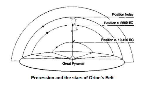
The reader is already familiar with the way the Earth’s axial precession causes sunrise at the vernal equinox to migrate along the band of the zodiac over a cycle of about 26,000 years. The same phenomenon also affects the declination of all visible stars, producing, in the case of the Orion constellation, very gradual but significant changes in altitude. Thus from its highest point at meridian transit (58o 11’ above the southern horizon as viewed from Giza) it takes Al Nitak about 13,000 years to descend to the low point, last registered in 10,450 BC, that is immortalized in stone on the Giza plateau – i.e. 11o 08’. As another 13,000 years pass, the belt stars very slowly rise again until Al Nitak is back at 58o 11’; then during the next 13,000 years they gradually fall once more to 11o08’. This cycle is eternal: 13,000 years up, 13,000 years down, 13,000 years up, 13,000 years down, forever.
It’s precise configuration for 10,450 BC that we see on the Giza plateau – as though a master-architect came here in that epoch and decided to lay out a huge map on the ground using a mixture of natural and artificial features. He used the meridional course of the NileValley to depict the Milky Way, as it looked then. He built the three pyramids to represent the three stars, exactly as they looked then. And he put the three pyramids in exactly the same relationship to the NileValley as the three stars then had to the Milky Way. It was a very clever, very ambitious, very exact way to mark an epoch – to freeze a particular date into architecture if you like…
Angkor constructors worked according to a single project design received from the outside, which for some reason they had to implement within a certain time span. The existence of a similar design for Giza in 2500 BC could also unravel the mystery of emergence of the Great Pyramids and other smaller structures in Saqqara (it’s about the Pyramid of Djoser, built by Imhotep and referred to in Sensei-IV book) in view of the Pyramid Texts
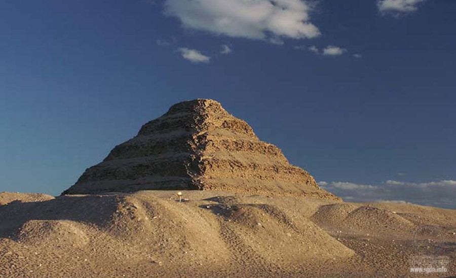
These enormous cult buildings of Dynasties IV, V and VI have had neither preceding nor subsequent analogues. And just like the pyramids, temples, bas-reliefs and inscriptions in Angkor, they were completed within about 420 years (from 2575 to 2152 BC).
Jayavarman II could bring the design with him, when he arrived to Cambodia “from overseas” in 800. Or he could get it from the Brahmin, “skilful in magic”, who consecrated him godlike king in 802. We can only make assumptions. His forty-year “going round” the site, as well as behaviour of the subsequent monarchs, accords with the project implementation. All in all, we have an impression that each of Khmer rulers contributed to the project according to their individual capabilities: some only built a singular temple in one or another place, while others – especially Suryavarman II and Jayavarman VII – within a relatively short time span erected a whole sequence of large monuments. Moreover, only few of the monarchs managed to revel in peace: the majority had to defend their borders from hostile barbarian hordes and simultaneously continued erecting 72 large buildings in the Mekong Plain according to the design, which buildings deservedly granted Cambodia the name of the “Heaven-Like Land”.
Number 72 is found in Angkor in other forms as well, but I won’t dwell on this in detail. My task is to cite extracts which associate Angkor with the sky and Egypt. The beginning of Angkor construction obviously related to emergence of Sokrovennk who apparently provided Jayavarman II or one of his retinues, possibly Brahmin, with the “Star Map” mentioned in Sensei of Shambala (Book IV), by which Imhotep had been constructing the pyramids. A relevant extract was given in the article Human energy structure. Truncated pyramid with a detached top, so I won’t repeat it.
The life and activities of Jayavarman VII deserve a special study. Throughout the 38 years of his reign he was purposefully and vigorously erecting not just the huge wall around Angkor Thom, but also Ta Prohm, Banteay Kdei, Neak Pean, Ta Som, Srah Srang temples, the so-called Terrace of the Elephants and Terrace of the Leper King (both on the Angkor Thom site), Krop Kroh, Prea Papilay, Prasat Suor Prat, Preah Khan and, last but not least, Bayon.
We can understand researchers who call Jayavarman the megaloman and say that the motive of his gargantuan construction programme was a sweet call of his overblown ego: “the inexhaustible willpower in mania’s service”, as one critic said. However, among his buildings there are many of those which correspond to the main stars of the Draco constellation, and this may hardly be explained by a mere chance. Moreover, several objects represent earthly reflections of conspicuous stars of the adjacent Upsa Minor (Little Bear) constellation – and in such position as they were at dawn on the vernal equinox day in 10,500 BC.
The complex of buildings erected by Jayavarman VII and mimicking the sky on the earth includes Angkor Thom, Ta Prohm (1186), Banteay Kdei (considered the earliest of his temples), Neak Pean, Ta Som, Srah Srang, Preah Khan (1191), and the last – most brilliant and impressive Bayon completed in 1219 right before his death.
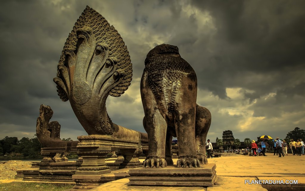
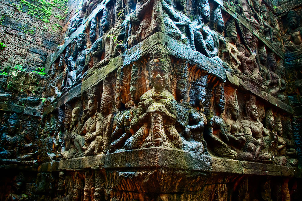
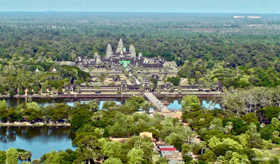
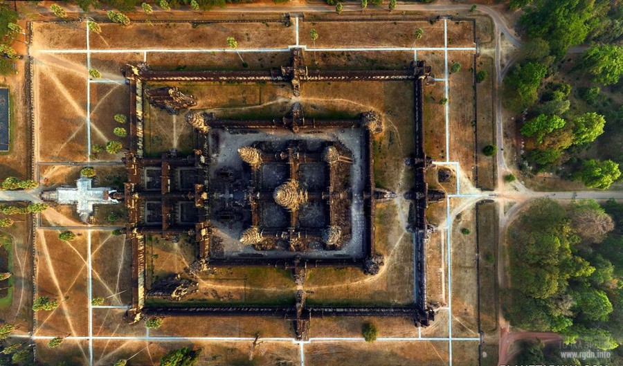
It might all be an accident and modern historians might be 100 per cent correct when they allege that this high-speed building programme was just megalomania, resulting in the random construction of many temples here and there: ‘an orgy of building, a brief yet sustained period of hectic, almost crazy architectural creation’. Yet in inscriptions from which we have already quoted in earlier chapters, Jayavarman sounds far from crazy or egocentric. On the contrary, he tells us explicitly that his temples were part of a grand scheme to win the ‘ambrosia of immortality’ for ‘all those who are struggling in the ocean of existence’. We know, too, that he saw the Angkor monuments as effective instruments in this quest because of their special qualities as ‘mandalas of the mind’.
***
It is easy to see how the behaviour of Orion and Draco, and thus their cosmic functions, could have come to be seen as linked by the ancients. Indeed, as scientific observations have confirmed, they are linked, by the cycle of precession, in a great cosmic see-saw which swings up and down like the pendulum of time itself. Computer simulations covering thousands of years show us that as Orion’s altitude at the south meridian steadily rises, Draco’s altitude at the north meridian steadily falls. When Draco reaches its lowest point, Orion reaches its highest point. Then the opposite side of the cycle begins with Draco steadily rising and Orion steadily falling. The ‘up’ motion takes just under 13,000 years. The ‘down’ motion takes just under 13,000 years. And so it proceeds, up for 13,000 years, down for 13,000 years – to all extents and purposes for ever.
What is particularly intriguing is that the sky-ground plans of Angkor and Giza have succeed in capturing the highest point in Draco’s trajectory and the lowest point in Orion’s – the end in other words, of one half-cycle of precession and thus the beginning of the next. This last happened, we know, around the year 10,500 BC, in which epoch the ecliptic north pole lay due north of the celestial north pole at dawn on the spring equinox and the pattern of the stars in the sky was taken as the template for the pattern on the ground of the monuments of Angkor and Giza.
Since that golden age, rotated by the churn of precession, the celestial pole has travelled a full half-circuit around the pole of the ecliptic. The pendulum of Orion and Draco has likewise swung back almost as far as it can go – with Draco now at its lowest point and Orion at its highest.
As in 10,500 BC, in other words, the time-keepers of the sky, who stand at the gates of immortality, are poised to go into reverse again. Any initiate steeped in the Hermetic dictum ‘as above as below’ would be bound to interpret this configuration as a sign that some great change is imminent – a change that could be for the better, or greatly for the worse, depending on humanity’s own choices and behaviour.
The author’s words in the last paragraph are very nice, aren’t they? Intuition is a wonderful thing.
We can make a brief summary of all the aforesaid:
Let me also cite an extract from Sensei of Shambala book:
Well, if mankind as a whole was evaluated as a spiritually progressing society, it was preserved. Whereas if more of the beast, i.e. material nature prevailed in it, then the same story of “global cataclysms” repeated, which happened to some other previous civilizations. And not more than one-tenth of the total population was left for “breeding” of matter for the souls of the next civilization... Mankind chooses the path for itself, while actions of Shambala are just the consequences of such choice. (Sensei of Shambala book)
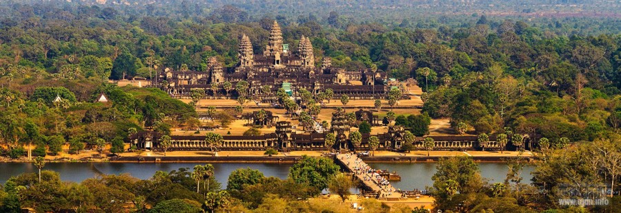
Panorama of Angkor, a very beautiful place:
Below there is an interesting video with the author of the books. There are ancient maps, Giza pyramids, Angkor temples, and, most interestingly, at the end he cites Asclepius, very nice lines. And thereafter this man, who has spent decades delving into history; who is familiar with numerous ancient texts and ancient monuments, and whose researches puzzle contemporary scholars, starts talking about the choice, the crossroads and love. This is simply a person who cares. His words are wonderful – you should take time and listen.
Another video with the author of the books: here there are not just Giza pyramids and Angkor, but also other cult buildings across the globe. Besides, the author mentions a comet that fell to the Earth about 13,000 years ago.
Some information about the comet:
Received from Igor
 The revealed secrets of Angkor and Giza plateau – the pendulum of Orion and Draco. Apocalypse now?
votes:
618
|

Project Aim


Leave comment