

It seems to us the veil has been lifted from many secrets owing to the recently published series of resonant articles Star. The Golden Ratio. We started to search for clues to puzzles and decided to follow a natural and gradual way, not jumping over steps, but going like a child: step one, step two, step three... collecting and referring to interesting facts and building hypotheses. Today we shall make our first step on which we’ll elucidate information about the five points of the Star “drawn” (see map below) in the final article of the aforesaid series, entitled A new look at an old design. Jim Alison’s lines, and this is from where we will depart. This is our first hypothesis-drawing attempt, and nobody knows what we’ll eventually arrive at. We kindly invite everyone to join discussions and share opinions. Perhaps, our joint efforts will take us somewhere. As a matter of fact, joint efforts is our great advantage, so let’s delve into the subject together in order to prevent any possible attempts to claim ownership of information and hypotheses presented herein.
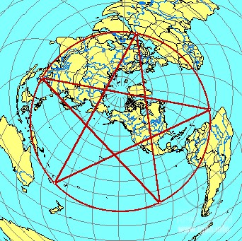
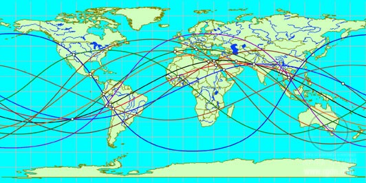
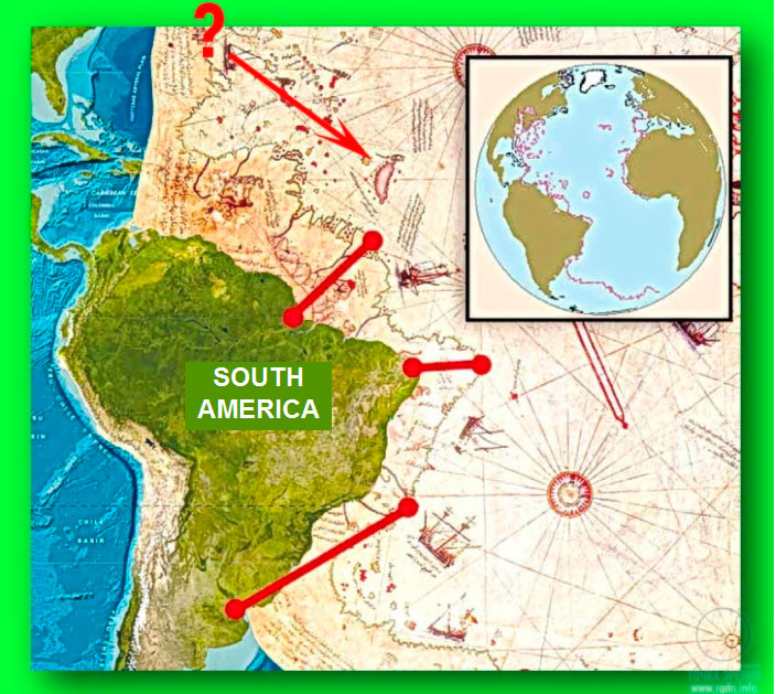
So, what do we have? We have Star. The Golden Ratio article series, relevant comments to the articles, a new look at an old design (Jim Alison’s lines), and the five points of the five-pointed star where the vertices are the Pyramids of Giza, Easter Island, Angkor, Anatom (Aneityum) Island, and a point in the Atlantic Ocean where presumably an island used to be located.
Well, let’s start with Egypt as usual.

Official data:
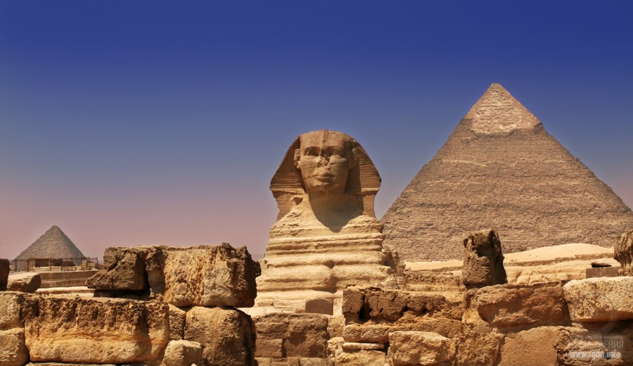
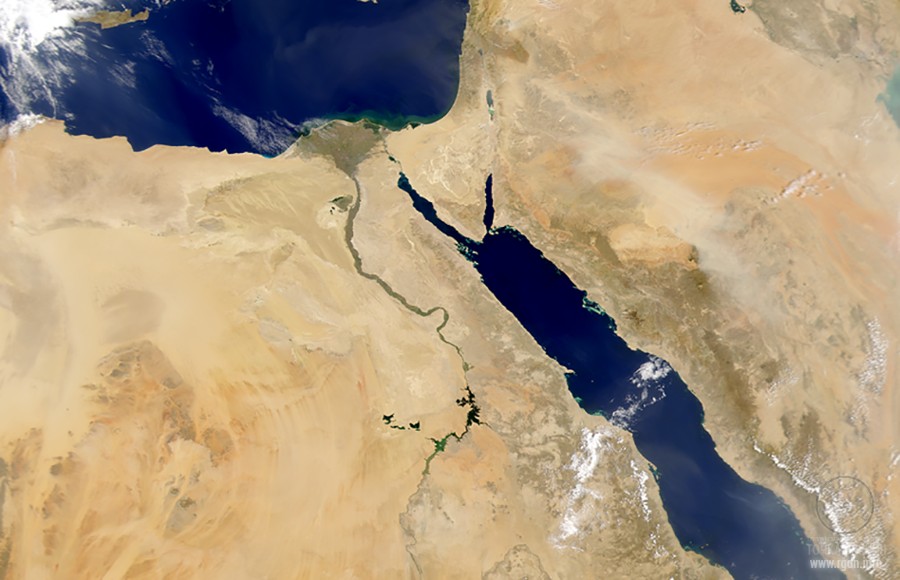
The Giza pyramid complex is an archaeological site on the Giza Plateau, on the outskirts of the Egyptian capital. It is located in the Libyan Desert, approximately 9 km (5 miles) west of the NileRiver at the old town Giza, and about 13 km (8 miles) southwest of Cairo city centre. It is generally considered the structures on the site were built in ancient Egypt in the times of the 4-6th Dynasties (26th – 23rd centuries BC).
The Pyramids of Giza complex consists of the Great Pyramid of Giza (also known as the Pyramid of Cheops or Khufu), the somewhat smaller Pyramid of Khafre (or Chephren) a few hundred metres to the southwest, and the relatively modest-sized Pyramid of Menkaure (or Mykerinos) a few hundred metres farther southwest. The Great Sphinx lies on the east side of the complex. Many Egyptologists still believe that the head of the Great Sphinx is that of Khafre. Along with these major monuments are a number of smaller satellite edifices, known as “queens” pyramids, causeways and valley pyramids. The surface of the pyramids used to be covered with plates of polished white limestone. After the Egyptian civilization downfall the limestone was pilfered by local dwellers for their personal needs.
Information referred to in the article The revealed secrets of Angkor and Giza Plateau – the pendulum of Orion and Draco. Apocalypse now?
We already know that the three Pyramids of Giza in Egyptmodel the Belt stars of the southern constellation of Orion.
At Giza we have ‘Orion temples’ in the form of the Great Pyramids looking like Orion in 10,500 BC, and ‘Leo temples’ in the form of the lion-bodied Sphinx and the adjacent structures looking like Leo in 10,500 BC.
West’s evidence focused on certain key structures, notably the Great Sphinx and the ValleyTemple at Giza and, much farther south, the mysterious Osireion at Abydos. He argued that these desert monuments showed many scientifically unmistakable signs of having been weathered by water, an erosive agent they could only have been exposed to in sufficient quantities during the damp ‘pluvial’ period that accompanied the end of the last Ice Age around the eleventh millennium BC. The implication of this peculiar and extremely distinctive pattern of ‘precipitation induced’ weathering, was that the Osireion, the Sphinx, and other associated structures were built before 10,000 BC.
There is an interesting extract in Sensei of Shambala (Book IV):
‘Sensei, you’ve mentioned a global-scale project associated with the pyramids, as if it was developed long before the times of Imhotep. Who could possibly develop it long before Imhotep’s times? The East is certainly the cradle of human civilization. But, according to researchers, long before that time there was nothing like civilization… There were only hunters and gatherers, i.e. the most primitive humanity.’
‘You are right about the new cradle. It was really so. But in those times the earth was visited even by such civilizations that don’t fit into the limits of the modern ‘historical’ concept… though their traces are found until now. Let’s take Baalbek with its huge slabs of a ‘landing ground’. Or the Great Sphinx situated not far from the ‘flower base’ and constructed of the monolith rock far before this civilization, including internal underground premises under it. By the way, this stone monument quite successfully survived the Flood.’
‘The Great Sphinx?!’ Slava and Yura asked simultaneously.
‘Yes, the Great Sphinx is an enormous sculpture of a lying lion with a man’s head and a peculiar cape hanging down from its head to its shoulders,’ Sensei explained habitually. ‘By the way, ‘Sphinx’ is far from being the genuine name of this structure. Actually it’s a Greek word meaning ‘the one who strangles’ and originating from the verb ’squeeze’, ‘stifle’. Greeks called so this statue because, when they were in Egypt, they associated it with a character from their ancient Greek legends – Sphinga (Sphinx). In Greece Sphinga meant a fairy animal with a woman’s head and chest, a lion’s body and bird’s wings. According to the legend, this creature lived on a cliff near Thebes and asked all passers-by an insoluble riddle, and when it didn’t receive the answer it strangled them. Since their legend resembled ancient Egyptian legends about goddess Sakhmet (a lioness with a human face), daughter of god Ra, who slew rebellious people, this name remained so in history.
At that, I would like to mention that the Greek legend emerged from a more ancient version about predator Phix which lived in Boeothia on MountPhikion. It was a cruel monster able to swallow its prey. Oedipus defeated it in a fierce fight. And the very character of Sphinga appeared in Greece under the influence of the Asia Minor character of a winged half-virgin and half-lioness.
As for the Great Sphinx, in Egypt it was actually named Harmahis and symbolized the sun rising in the East and resurrection. But these notions resulted from earlier ideas about the Great Sphinx as the ‘Guard of gods’ home’. It wasn’t occasional, since this structure guards the secret of the path leading to the LotusTemple, one of the most ancient underground buildings at the site.’
‘Incredible!’ Our guys exclaimed with delight.
‘Really?’ Nikolai Andreevich became alerted. ‘Could you please tell us more…’
‘What does it mean the Great Sphinx is “situated not far from the flower base’?’ Victor asked almost simultaneously with Nikolai Andreevich.
Sensei waited with the answer a little.
‘Well, I will tell you about the LotusTemple once later. At that I can add some details about the ‘flower’ now. I have already told you that Ta-Kemet was a special place for Shambala in the times of extreme antiquity. Even its location is not simple if we take into account the geographical region of this place on earth, its coordinates and view from space.’
‘View from space?’ Stas asked with curiosity. ‘What is so interesting about that region? The biggest part of the area is occupied by the desert.’
‘Not only the desert,’ Sensei objected. ‘Moreover, incidentally the desert was not always there. Twenty thousand years ago, when a larger part of Europe was covered with ice shelves, North Africa was a rather flourishing earthly paradise. Once the ice went away and climate turned drier, periods of droughts set in. But we won’t talk about that now. If we look from the outer space at the geographical region of the northeast African continent, we can see a beautiful blossoming flower of a blue lotus amidst the desert sands, which is shaped by the Nile river (by the way, if someone doesn’t know yet, it’s the longest river in the world today). Due to its broad triangle and bowl-shaped delta flowing into the Mediterranean Sea, petal-shaped veins of rivers in the region of the delta itself as well as the long serpentine band of the river, the Nile resembles a blossoming flower of lotus on a long stalk. Whereas twelve and a half thousand years ago, owing to the coastal line of this delta, the resemblance with petals of the lotus flower was perfect. At that time Shambala or, to be more precise, the Shambala Threshold was situated almost at the ‘flower base’. Its previous location was on the side of a magnificent lake in the place where the Black Sea waters lap nowadays; and the next location was already in the mountains of Belovodye where the Shambala Threshold is situated to this day.
So, it is no mere chance that in legends associated with their gods ancient Egyptians depicted exactly a three-petal lotus that is young and blossoming as a symbol of young (renewed) humankind. Furthermore, not by occasion the cosmic deity Khapi was considered to be the god of the Nile, and his symbol was lotus (much later papyrus was added, and due to an impudent invention of one of priests they began to depict Khapi as a fat man with a pot belly and female breasts). Moreover, it is no mere chance that Khapi was also referred to as one of the four sons of god Horus. Let me mention that Horus’s name is translated as ‘height’ or ‘sky’, and his symbol from the time immemorial was a solar disc with outstretched wings. I would also mention that initially Horus’s children were regarded as astral gods, satellites of the constellation of Cow Leg (Ursa Major) in the northern sky. Hence, those sons were deemed to be escorting Osiris. Horus assigned to each of them their places around the throne of Osiris. The main function of Horus’s sons was to guard Osiris, to protect him from enemies. At that, each of them stood on guard from a certain cardinal direction (Khapi was on the northern side). If you put all this information together and think well, you will understand a lot.’
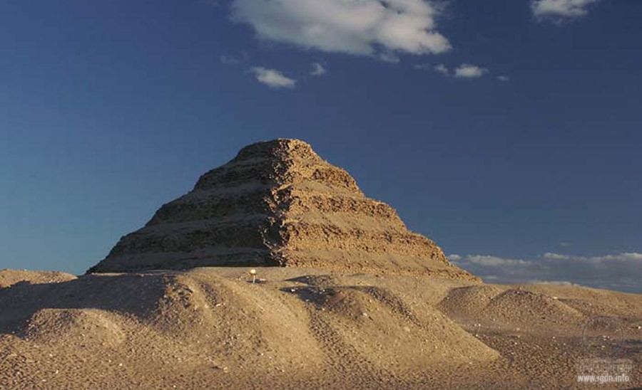
Another extract from the same book has also attracted our attention. It’s the story of the Pyramid of Djoser construction by Imhotep (read below):
The place chosen by Imhotep for construction of this truncated pyramid wasn’t occasional. It was on the verge of the plateau, that very plateau which was only a few kilometres to the north of the Great Sphinx. When Imhotep showed the site layout to the pharaoh, priests and aristocrats, he explained the choice of this place of deserted plateau as a closer location to Memphis and a beautiful view from that place on Memphis. But in actual fact this place fully matched one of the earth geographic coordinates marked on the ‘star map’ revealed to him by the Sokrovennik. The Great Sphinx erected far earlier than that time (and not after Imhotep’s life as they assume it now, as if it were during the time when the Great Pyramids were built!) was an important reference point for precise and accurate location of the truncated pyramid.
Thus, the grandiose construction was intentionally extended for several decades. Why? Because it wasn’t enough to build the object, it was necessary to ‘launch’ it as well. For doing this the most important were highly spiritual people, both men and women. Imhotep spent many years for their upbringing and education, that’s why he actually extended the terms of construction, explaining the delay to the elite as improvement and modernisation of his architectural plan.
We don’t have a clear notion of what the ‘star map’ is, although it was mentioned on our website several times already, in particular in the Star. The Golden Ratio article series.
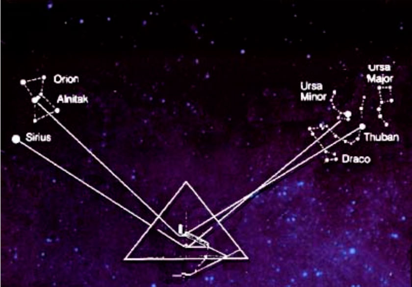
There is one more interesting point though. The Great Pyramid was built in such a way that some internal “sealed” shafts are oriented at certain stars in cosmic space as shown in the picture below. More about such correlations may be found in the works by the famous researcher Graham Hancock.
What preliminary conclusions can we draw?
“Our land used to be a big, very big country…
Waves rose, and the country turned small.”
(a myth about the creation of Easter Island)
Official data:
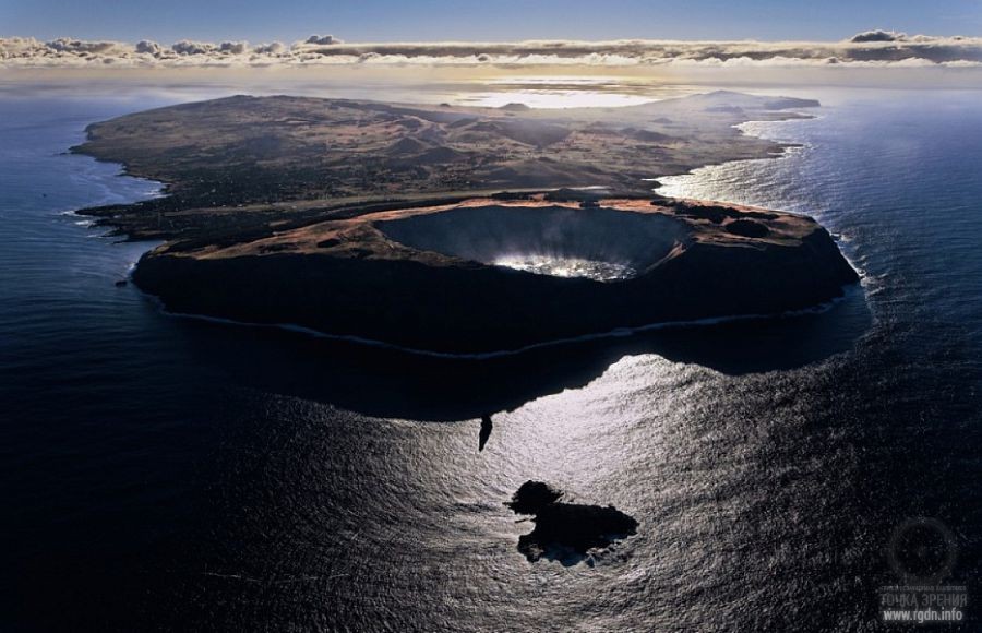
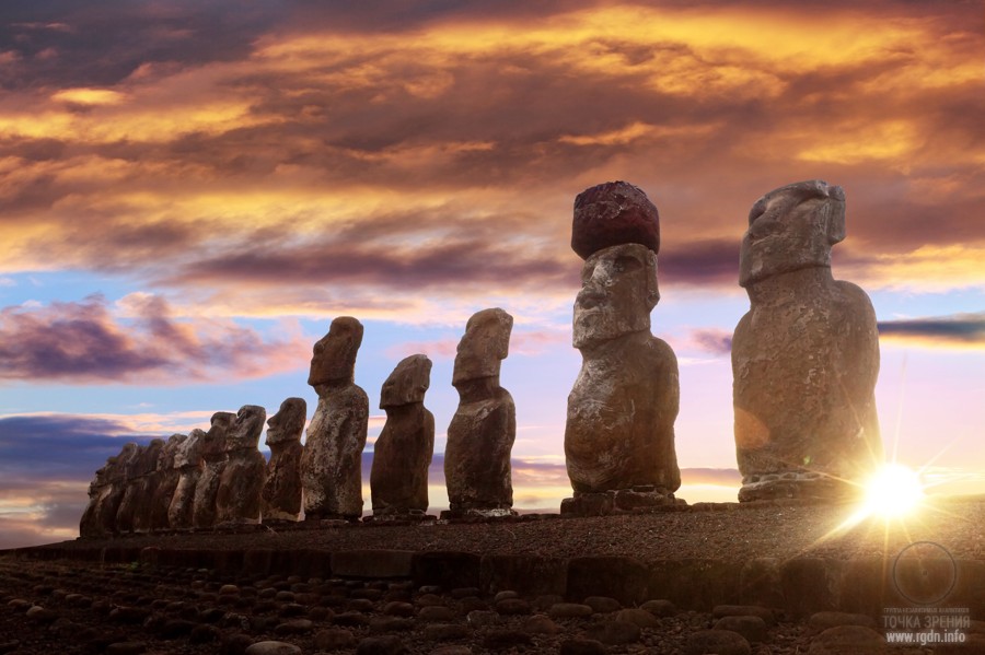
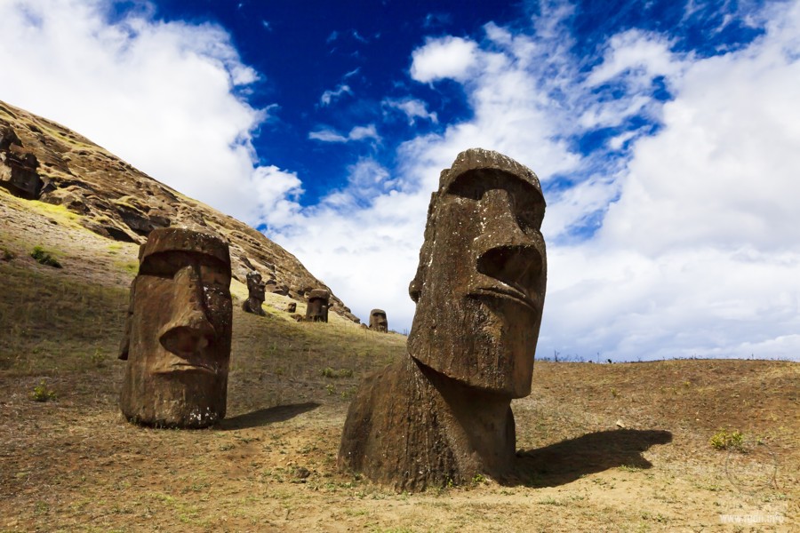
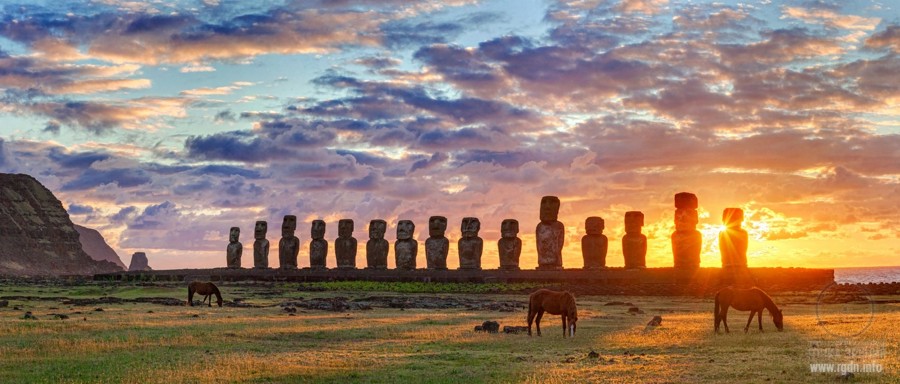
Easter Island (Rapa Nui) is one of the remotest populated islands in the world. Due to its extreme isolation the history of the island is truly unique. There are numerous scientific hypotheses and assumptions on the time of the island occupation and the reasons of extinction of the local civilization, representatives of which erected huge stone statues (moai) and knew Rongorongo script that is not deciphered by linguists until today. After the island was discovered in 1722 by the Dutch traveller Jacob Roggeveen and the first Catholic missionaries appeared, drastic changes took place in the life of Rapa Nui inhabitants, and the former hierarchical relations were forgotten. In the middle of the 19th century the islanders turned into objects of slave trade. Consequently, most of the native population died and many elements of the unique local culture got lost.
We wrote about the marvellous and mysterious island earlier in Which secrets are hidden on Easter Island? and Easter Island recluses. Here are some extracts from those articles:
Some legends assert that Easter Island was once a part of a big country (many believe it’s an extant part of the Atlantis). This looks rather probable, since nowadays plenty of evidence is discovered there, supporting such legends: there are roads on the island, which lead straight into the ocean; numerous underground tunnels have been found, which begin in local caves and run in unknown directions; and there are other not less significant records and amazing finds.
We made a shot on Google Maps and marked red arrows on the lines that presumably indicated underwater roads. We hurried to do so because the roads might soon be erased on satellite images by a special order “from above” as it was done many times before with such images (internet users widely mention that).
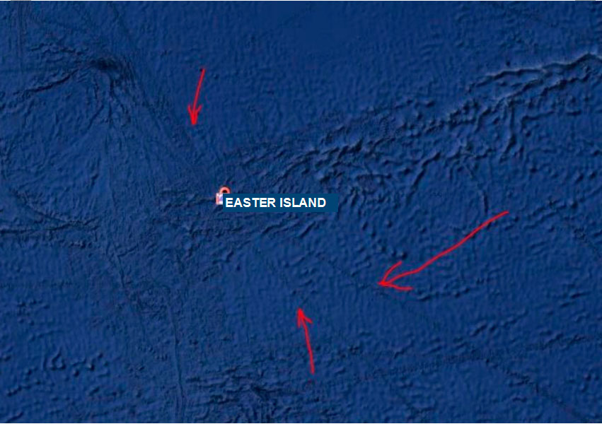
In 1973-1977 several American oceanologists investigated ocean cavities near Easter Island, namely near the Salas y Gómez Ridge. Eventually they found 65 underground peaks and agreed with a hypothesis of the existence of an unknown archipelago that had been in this area tens of thousands of years ago and then went underwater. However, all subsequent studies were blocked on the Chile government demand without any sound reason. The “island of riddles” does not let anyone unravel its mystery until today.
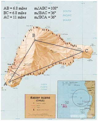
Moreover, we cannot omit the unique geometric peculiarities of Easter Island as described in the article A new look at an old design. Jim Alison’s lines:
Easter Island is triangular and the three volcanic peaks on Easter form an isosceles triangle with an apex angle of 108° and base angles of 36°. The ratio between the length of the base and the lengths of the sides precisely expresses φ (6.8 miles x 1.618 = 11 miles).
A quote from the AllatRa book:
Anastasia: A few more words about Easter Island. The local population has preserved legends that ceremonial platforms (“ahu”), on which some of the stone statues are located, serve as a link between the visible and the invisible (the beyond) worlds and that the very stone statues (“moai”) contain a supernatural power of their ancestors. The latter, according to relevant beliefs, is supposedly capable of regulating natural phenomena and thus leads to a successful outcome, the prosperity of the people…
Rigden: There is nothing supernatural there. It is just that in ancient times there lived people who knew how and for which purpose certain signs were to be activated. Had their descendants not lost the knowledge they were given, then the people who currently inhabit the island would understand themselves and the basic connection with other worlds better. Usually for the chronicle, as transfer of knowledge and legends for descendants, knowledgeable people drew signs on stone statues, and they often adorned themselves with corresponding tattoos that had a special symbolic meaning. For uninformed people those were drawings that meant absolutely nothing, but instilled respect to and fear of those who, in their opinion, “probably knew something special.” Later on, of course, plain imitation started taking place.
It should certainly be mentioned that besides the Great Alignment forming a Star sign (Giza, Easter Island, Angkor, Anatom, and the point in the Atlantic Ocean) other alignments also pass through Easter Island, which indicates a particular importance of this place.
Preliminary conclusions:
Official data:
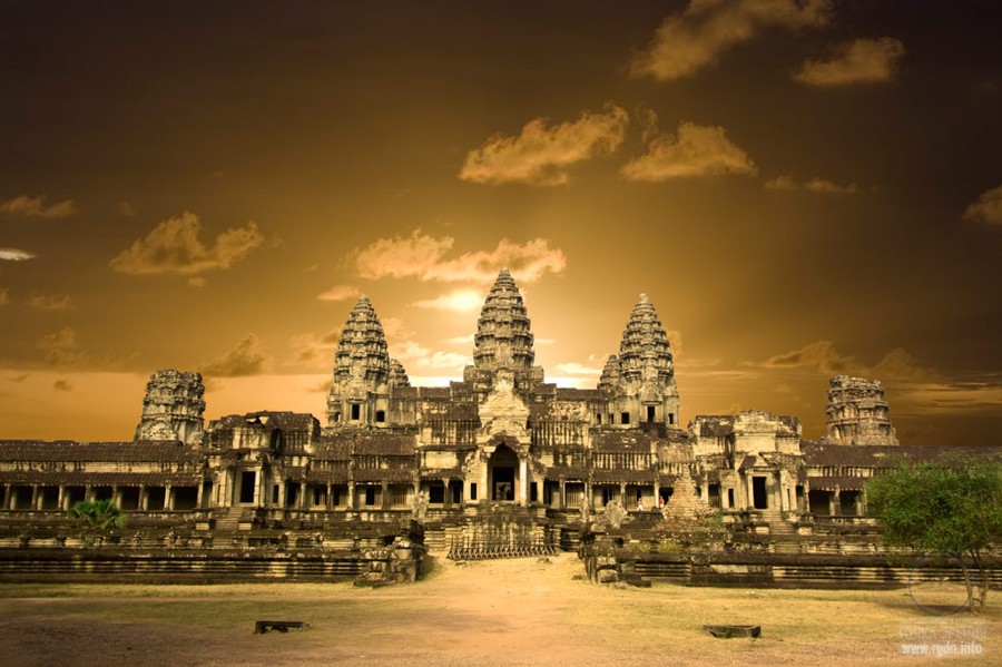
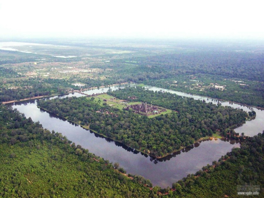
Angkor Wat is a temple complex in Cambodia and the largest religious monument in the world. It was originally constructed in the early 12th century by the Khmer King Suryavarman II as a Hindu temple of god Vishnu, and gradually transformed into a Buddhist temple toward the end of the 12th century. Angkor Wat combines two basic plans of Khmer temple architecture: the temple mountain and the later galleried temple. It is designed to represent MountMeru, home of devas in Hindu mythology.
The ancient Angkor temple site in Cambodia was described in our earlier publications: Angkor Wat: architecture, frescoes and sacral numbers 7 and 72, Angkor Wat: new unique photographs!, and The Orion-Draco Pendulum. Apocalypse now? Some extracts from the third article are given below:
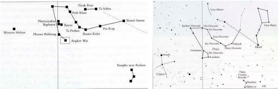
Just as the three great Pyramids of Giza in Egypt model the belt stars of the southern constellation of Orion, so too do the principal monuments of Angkor model the sinuous coils of the northern constellation of Draco. Indeed, not only do the stars of Draco seem to be depicted, but also the nearby stars of Alkaid and Kochab, which form a straight line with Thuban in the sky – which also happens ‘coincidentally’ on the ground – and Deneb in the constellation of Cygnus, which finds its matching temple in the Western Mebon. Furthermore, the temples were built over some 250 years and there is evidence for reusing old sites, such as the Bayon, the Baphuon and the Phimeanakas. It could be possible, then, that the positions of the temples were mapped out at the start of the enterprise.
Jayavarman tells us explicitly that his temples were part of a grand scheme to win ‘the ambrosia of immortality’ for ‘all those who are struggling in the ocean of existence’. We know, too, that he saw the Angkor monuments as effective instruments in this quest because of their special qualities as ‘mandalas of the mind’.
It is easy to see how the behaviour of Orion and Draco, and thus their cosmic functions, could have come to be seen as linked by the ancients. Indeed, as scientific observations have confirmed, they are linked, by the cycle of precession, in a great cosmic see-saw which swings up and down like the pendulum of time itself. Computer simulations covering thousands of years show us that as Orion’s altitude at the south meridian steadily rises, Draco’s altitude at the north meridian steadily falls. When Draco reaches its lowest point, Orion reaches its highest point. Then the opposite side of the cycle begins with Draco steadily rising and Orion steadily falling. The ‘up’ motion takes just under 13,000 years. The ‘down’ motion takes just under 13,000 years. And so it proceeds, up for 13,000 years, down for 13,000 years – to all extents and purposes for ever.
Since that golden age, rotated by the churn of precession, the celestial pole has travelled a full half-circuit around the pole of the ecliptic. The pendulum of Orion and Draco has likewise swung back almost as far as it can go – with Draco now at its lowest point and Orion at its highest.
As in 10,500 BC, in other words, the time-keepers of the sky, who stand at the gates of immortality, are poised to go into reverse again. Any initiate steeped in the Hermetic dictum ‘as above as below’ would be bound to interpret this configuration as a sign that some great change is imminent – a change that could be for the better, or greatly for the worse, depending on humanity’s own choices and behaviour.
Preliminary conclusions:

A silly question unintentionally arises: where did people appear from in the middle of the Pacific Ocean? We had to look into the books The Riddles of Three Oceans and Mysteries of the Pacific Ocean by Alexander M. Kondratov (1937-1993). Here are some extracts:
In the 16th century the Portuguese navigator Pedro de Quiros advanced the theory that the islands were the remains of a large, now submerged, continent, and their inhabitants were descendants of its population. Many other well-known navigators supported this view. Its most ardent champions were two students of Oceania, the distinguished French naval commander and explorer Dumont d'Urville and his fellow countryman Moerenhout, collector of folklore.
To support the idea that America and Asia were once joined by a large land mass Dumont d' Urville thought that Oceania's volcanic islands, such as the Hawaiian Islands, were the peaks of mountain chains which stretched across the now sunken continent. The continent, he said, had been inhabited by a large and civilised population whose descendants, now greatly degraded, remained on the Pacific islands and islets. Moerenhout, in his turn, used folklore as evidence that a continent had existed until a colossal cataclysm led to its submersion and the death of a great number of people.
Dumont d'Urville and Moerenhout published their hypotheses in the first half of the 19th century, when oceanographers, anthropologists, geologists, folklorists and ethnographers had only just begun to study Oceania. As new data came to light, new theories concerning a hypothetical Pacific continent appeared.
In a monograph published in 1865 the English naturalist Alfred Wallace, associate of Darwin, cited evidence to prove that the contemporary aborigines of Australia, the Papuans of New Guinea, the dark-skinned Melanesians and the light-skinned Polynesians were all descendants of a single "Oceanic race" that had inhabited a vast Pacific continent, now sunken. Thomas Huxley, another outstanding evolutionist of the 19th century, shared Wallace's view.
The hypotheses of biologists and anthropologists were supported by some geological theories, except that geologists put the disappearance of the Pacific continent at a far earlier date, before man had evolved. The French geologist, Hang, thought that a vast land mass, situated in the central part of the Pacific, began to submerge in the Mesozoic era, that is, between 100 and 200 million years ago. The German geologist H. Hallier agreed with him. In 1911 the Russian geologist Lukashevich compiled a series of maps of the hypothetical Pacific continent showing all the changes it underwent, up to and including its final submergence.
In 1923 and 1924 two books about the hypothetical continent appeared, written by men living in different countries and working in quite different fields of science; they probably did not even suspect each other's existence. They were Mikhail Menzbir, Russian pioneer in zoogeography, and J. Macmillan Brown, English ethnographer, who spent a lifetime studying the numerous tribes and peoples of the Pacific. The titles of their books were similar: Brown's The Riddle of the Pacific and Menzbir's Secrets of the Great Ocean.
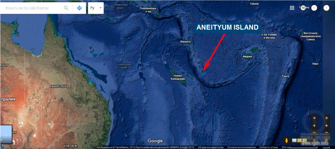
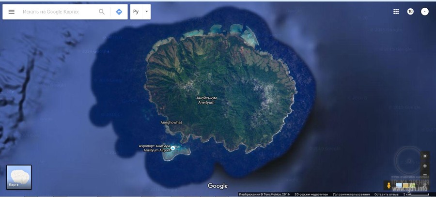
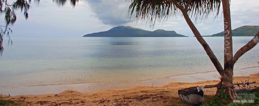
(Anatom Island has a shape similar to that of Pohnpei (Ponape) Island in Micronesia. – Note by the article author)
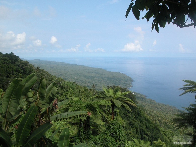
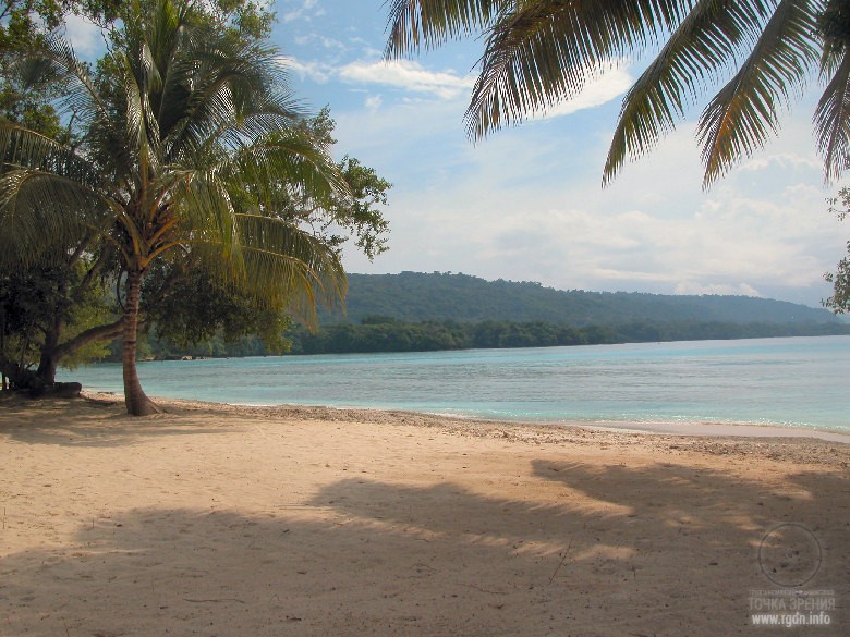
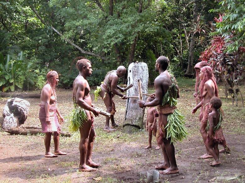
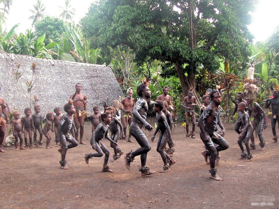
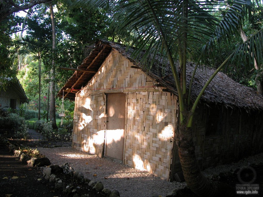
Anatom Island (also known as Aneityum or Keamu) is the southernmost populated island in the Republic of Vanuatu (formerly known as the New Hebrides) in the Pacific Ocean. It’s an oval-shaped island, 17 kilometres in length and 159.2 km² in area. Aneityum is of volcanic origin. Geologically it consists of two joined volcanoes that formed in the Pleistocene epoch. Volcanic activity in the island supposedly ended in the Holocen epoch. Its highest peak Inrerou-Atamvan reaches the height of 852 metres. Aneityum is surrounded by coral reefs and banks, has a mountainous relief and is covered with dense rainforests.
Current population of the island is about 915 people. Before the Europeans arrived here in 1793 Aneityum was inhabited by almost 12 thousand natives. Drastic decrease of the population was due to several factors, first and foremost diseases brought by the Europeans.
From the article A new look at an old design. Jim Alison’s lines:
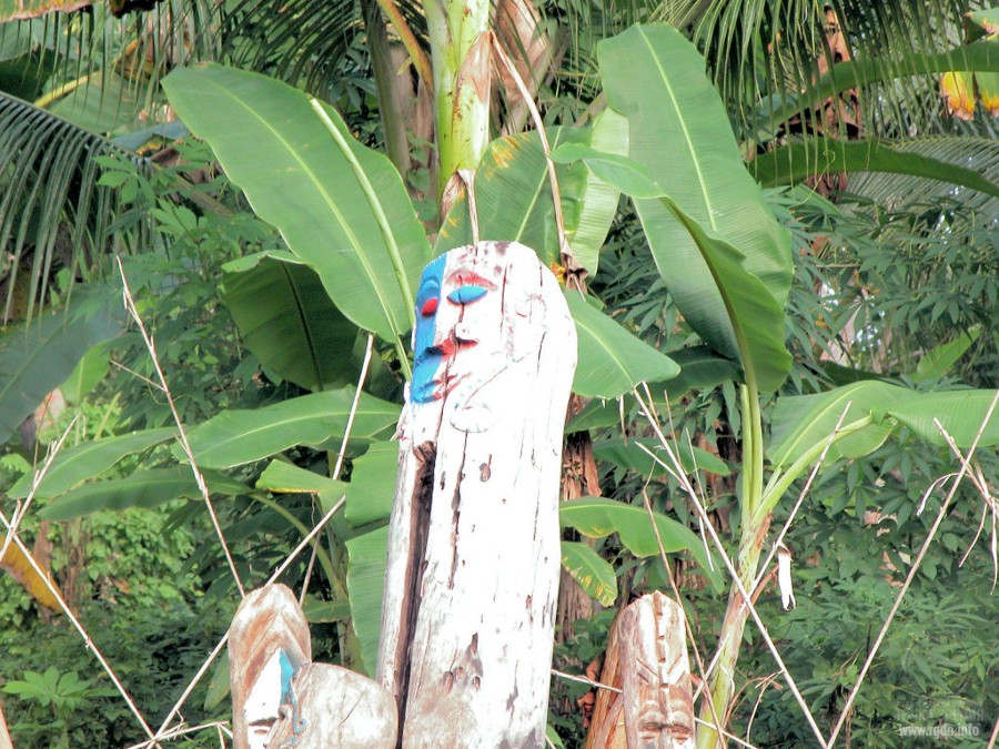
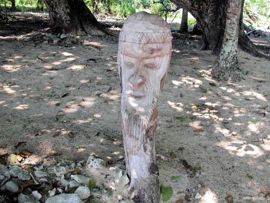
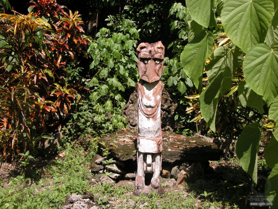
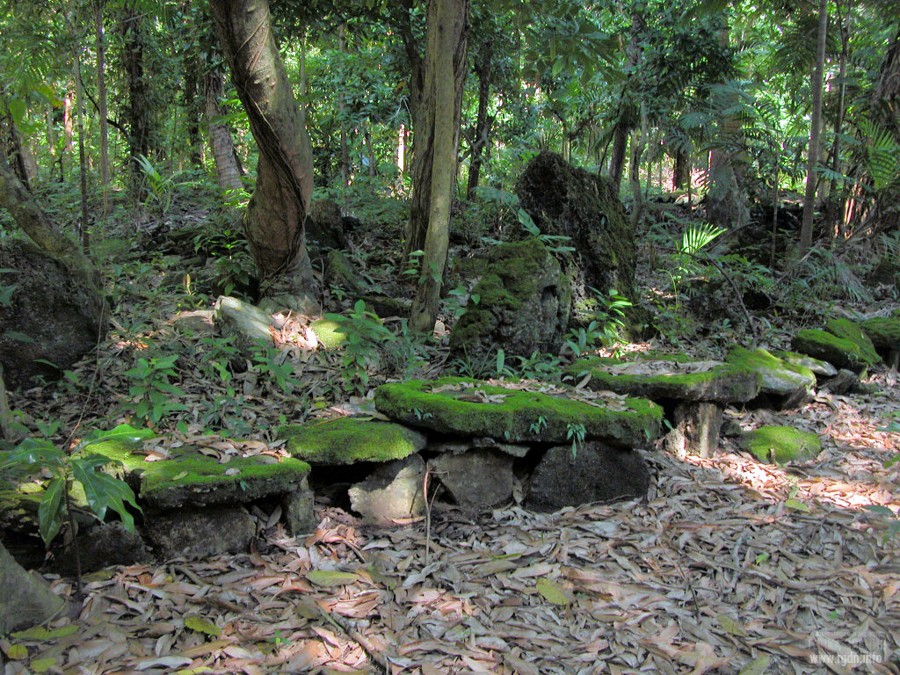
Northward of Anatom there is another island of the Republic of Vanuatu – the Malakula (Malekula) Island. Here’s a record about the island, made in 1972 by Alexander M. Kondratov (Soviet and Russian linguist, biologist and journalist):
For instance, on the Malakula Island, which is a part of the New Hebrides archipelago, still several years ago natives erected… stone dolmens and menhirs similar to those built in the Mediterranean many millennia ago! Local legends say the first dolmen on Malakula was erected in honour of a mythical personage Kabat. That Kabat arrived from faraway seas and brought diverse knowledge to the island.
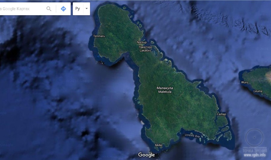
Quite interestingly, our initial attempts to surf the web for any evidence of the traces of an advanced culture on Malakula Island had no success. Neither Google, nor Yandex, or organic search, nor Google Maps, nor Google Earth gave any results. The author of these lines spent many hours examining the island on available satellite images. Is there no confirmation of Kondratov’s words about stone dolmens? It was very, very strange.
Only by the end of the next day we accidentally encountered such service as www.offthebeatentrack.at where relevant facts were finally found. Below we post a rather long image gallery, so that from now on anyone could google authentic photos of Malakula Island and view its life on the inside.


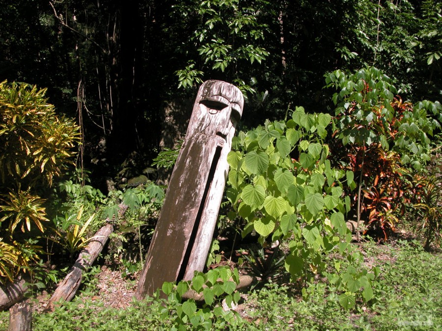
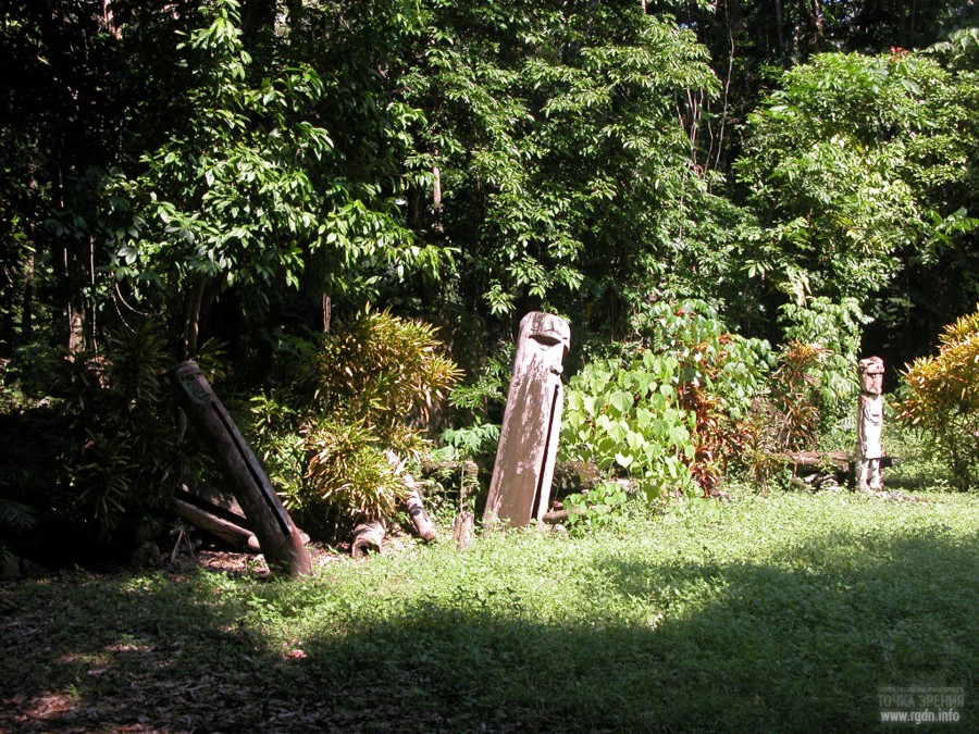
Here are the dolmens!

From the article A new look at an old design. Jim Alison’s lines:
“As for the fifth point, it is in the ocean, although in that place an island could be situated in ancient times as mentioned above. Even if we don’t take into account the last 2 points (Malakula is if fact at a considerable distance from Aneityum, while the last point rests against the ocean), the location of Giza, Angkor and Easter Island at the regular pentagon vertices (as parts of the IDSE system) or at the points of a star is still rather fascinating.”
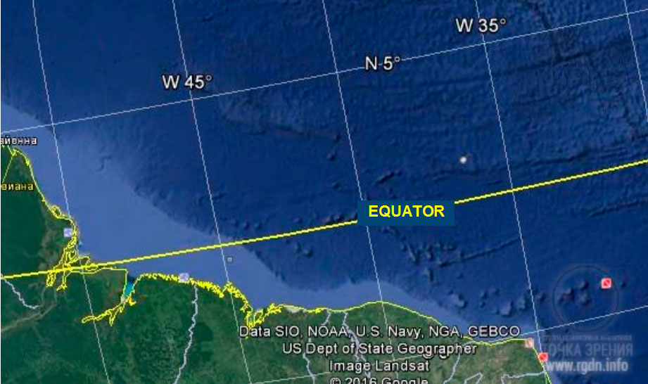
“Another possible Atlantis location is halfway between the Great Pyramid and Easter Island, at 4°19' north latitude, 41°30' west longitude, under the Atlantic Ocean northeast of the mouth of the Amazon.
On the diagram below, the marked locations are Giza, Angkor, Anatom Island, Easter Island, and 4°19' north latitude, 41°30' west longitude in the Atlantic Ocean.
The distance from the Great Pyramid to Easter Island is approximately 40% of the circumference of the earth. The marked location in the Atlantic is halfway between the two, 20% each way. Machu Picchu is halfway between Easter Island and the marked location in the Atlantic, 10% each way. The distance from the Great Pyramid to Angkor Wat is approximately 20% of the circumference, and the IndusValley (the antipode of Easter Island) is halfway between the two, 10% each way. The distance from Easter Island to Angkor is approximately 40% of the circumference, and Anatom Island is halfway between them, 20% each way.
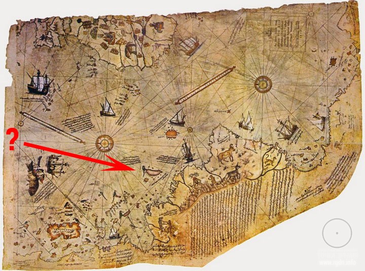
Although there are no islands in the Atlantic near 4°19' north latitude, 41°30' west longitude, it is interesting to note that the famous Piri Reis map shows a large island in this location, and the geology of recent core samples, taken from the ocean floor in this area, is of continental rather than oceanic type rock.” Read more about maps here.
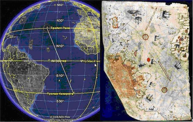
Attentively examining the ocean floor around the aforesaid geographic coordinates, we can discern the floor is not flat, but represents a surface with cavities and elevations that resemble ruined and submerged cities. We marked in red the point at 4°19' north latitude, 41°30' west longitude in the Atlantic Ocean. The elevation nicely visible at the ocean floor indirectly proves there was dry land in this place before the global sea level rose.
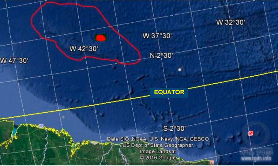
While searching for relevant materials on the internet, we noticed such phenomenon as “Google maps clean-up”. We even found a video where numerous facts are shown how the most strangely looking areas of the ocean floor were erased, which again evidences the existence of a certain force that has been hiding the truth form people for millennia (here’s a link to the video). Hence, we should not underestimate such opposing force, and even if you don’t see any relief particularities at the ocean floor on Google Maps this doesn’t mean they are not there.
At that, we would like to refer to another extract from Sensei of Shambala (Book IV) by A. Novykh:
Many artificially built pyramids, which are nowadays discovered by contemporary humanity, as well as those not ‘unsealed’ and not found yet, are far from being chaotic buildings. Though built in different times, they were placed in strictly determined coordinates, with strict orientation at certain stars as of the time of construction. Globally it’s a sort of a map. Initiators of such pyramids were people who possessed relevant knowledge, e.g. Imhotep. He received the information about the global architectural project (elaborated far before the time of Imhotep) from Sokrovennik, at the end of his several-year learning from him, along with other knowledge.
In the end we think it’s appropriate to cite the AllatRa book one more time:
... the five-pointed star is a working sign associated with the powers of Allat (manifested at the level of the fifth dimension); it belongs to the group of positively working signs. But such subtleties are only understood by people who work with signs in the invisible world. The sign of the five-pointed star activates a sense of justice and hope for the future in a person (at the subconscious level), and also encourages people to unite… In the case of the five-pointed star, no matter if it is pointing up or down, it will still be a sign of one of the generative powers of Allat… Since ancient times, the star has served as a symbol of victory of the spiritual nature over the material nature… The sign of the star only gives a positive impetus, a surge of energy for a certain change. And where it is later on directed by people is a matter of human choice… The star encouraged a positive surge in the masses, gave motivation, inspired for action while stimulating a yearning for the better in people in terms of their inner disposition. That is why people went towards such transformations in society with faith, a positive attitude, a hope for a better life and future, with a desire to attain the long-awaited Freedom. This is exactly the manifested effect of the sign on the masses.
Hopefully, to be continued...
Prepared by Maxim Perepelitsa & Dato Gomarteli
|
|

02.08.2017

10.07.2016

25.07.2016

31.07.2016

Project Aim


Leave comment